
Three routes set to improve options for travelling around Enfield without a car

A slew of new cycle lanes and improvements for pedestrians are being proposed by Enfield Council to improve links between the east and west of the borough.
Three planned east-west routes are now open for public consultation; between Enfield Town and Ponders End, Enfield Town and Enfield Highway, and Great Cambridge Junction and North Middlesex Hospital.
In addition, more details have been revealed of the major new cycling and walking route set to be installed along the New River from Enfield Town up to the M25 border with Broxbourne.
The three new east-west routes are designed to improve safety for cyclists and pedestrians, helping them to navigate dangerous roads such as the A10 and encouraging residents to ditch their cars as a result.
The link between Enfield Town and Ponders End will directly connect the borough’s two major existing cycling schemes; the C20 route that runs between Palmers Green and Enfield Town and the C1 route between Edmonton and Freezywater. The latter of these has only recently been fully completed, with new segregated cycle lanes launching in Ponders End last month.
Previous proposals for this east-west link had included the installation of cycle lanes on Southbury Road, but this option was deemed too difficult to implement. Instead, the new proposal will take cyclists along a more indirect route via Bush Hill Park, Lincoln Road and Derby Road, before continuing through Ponders End Park and ending at Ponders End Station.
Various types of cycle-friendly interventions are proposed along the mainly residential streets in addition to an upgrade of the Lincoln Road and A10 junction and, east of this junction, a two-way cycle track between Lincoln Road and Derby Road. A two-way track would also be created within Bush Hill Park.
The Enfield Town to Ponders End Station walking and cycling route project manager, Carlo Romano, told a recent public webinar: “The project will deliver a key active travel link which will provide increased access for residents. It will contribute to a long-term increase in active travel by expanding the borough-wide network.”
A public consultation on the Enfield Town to Ponders End Station route is open until 12th February.
The second proposed east-west link would connect the New River at Tenniswood Road with Brick Lane in Enfield Highway. It would pass Enfield Playing Fields and the QE2 Stadium before navigating the A10 with a new crossing and then joining Brick Lane. No segregated cycle lanes are proposed, instead the route makes use of quieter residential streets and existing footpaths. A public consultation is open until 8th February.
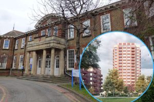
The third proposal is for a route linking Great Cambridge Junction and Bridport Road, which will connect cyclists with another ‘active travel’ scheme currently being installed around North Middlesex Hospital. The designs for this scheme are said to be “at an early stage” with an interactive map on the council website giving residents a chance to contribute to the development of the plans until 19th February.

In 2021 the council announced a plan to create a cycling route between Enfield Town and Broxbourne, via the New River. The first part of this scheme is largely complete and now links Enfield Town Station with Tenniswood Road, but the New River section of the scheme still needs to win planning approval. It would see a shared walking and cycling path installed alongside a two-mile stretch of the New River, from Tenniswood Road up to the borough border with Broxbourne, where the aqueduct crosses the M25.
The scheme will involve installing new bridges – including one over the Turkey Brook – plus lighting and pedestrian crossings. Detailed plans for this infrastructure work have now been submitted as a planning application, scheduled for determination in March. A new YouTube video shows a visualisation of the route.
Local news needs your support
We are proud that we were at the forefront of reporting on the recent local elections. We can’t do this without the support of our readers.
Independent news outlets like ours – reporting for the community without rich backers – are under threat of closure, turning British towns into news deserts.
If our coverage has helped you understand our community a little bit better, please consider supporting us with a monthly, yearly or one-off donation.
ACT NOW!
Monthly direct debit
![]()
![]()
Annual direct debit
![]()
£5 per month supporters get a digital copy of each month’s paper before anyone else, £10 per month supporters get a digital copy of each month’s paper before anyone else and a print copy posted to them each month. £50 annual supporters get a digital copy of each month's paper before anyone else.

More information on supporting us monthly or yearly
More Information about donations